Ascent of the Cherle


From Piazza di Carbonare (1076 m) to the heights of the Cherle (1440 m)

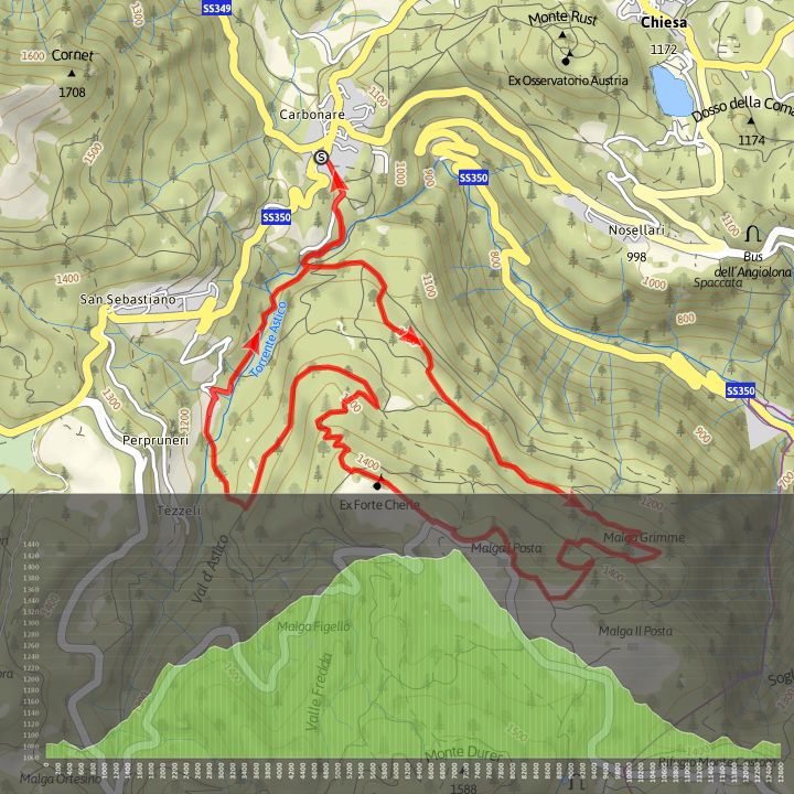
The route goes from Piazza di Carbonare (1076 m) to the heights of the Cherle (1440 m) and the first section requires good uphill ability. From Carbonare follow the path that descends to join the dirt track that goes from
Cogola to the Astico torrent, which you cross on the Pont dei Mirandoi bridge and ascend the forested south-eastern side of Dosso Cherle, passing the ex Malga Grimen.
After a steep climb up the dirt track you reach the wide meadows of Malga Seconde Poste, from where, turning right, you proceed rising and falling, passing alongside the Cherle Hotel, to reach the summit of the Dosso (Forte Cherle, 1914-18 war), from where you descend on an easy panoramic road.
hen you reach the Grimen dirt track, turn left. Follow the road for a while and then turn right and descend into the top of Valle dell’Astico to reach the small hamlet of Cùeli. Go through the hamlet and an easy dirt track leads back to Carbonare.
Download the route maps
Difficulty Easy
Time 2 hours
Maximum altitude 1441 m
Distance 12,5 km
eight difference in ascent 631 m
Height difference in descent 629 m
Distance for E-BikesShort
Circular route